Walkthrough of OSINT Exercise 001 by Sofia Santos
Watch me attempt to get back into OSINT. These walkthroughs are mostly a way for me to progress, and take accountability when I fail. Hope it'll be useful to someone else, or at least entertaining.

Today I'm diving into the first OSINT exercise Sofia Santos published on her website: https://gralhix.com/list-of-osint-exercises/osint-exercise-001/ She ranked it hard for beginners, medium for experts.
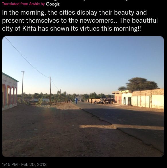
The task is to find the coordinates of where the photo from this tweet has been taken:
Full disclosure: I solved this exercise a little more than a year ago. I didn't document my process back then and I don't remember much of it, but I think it's still important to mention even if this walkthrough is a fresh start.
The Easy Part
I went on Google Maps and typed "Kiffa".
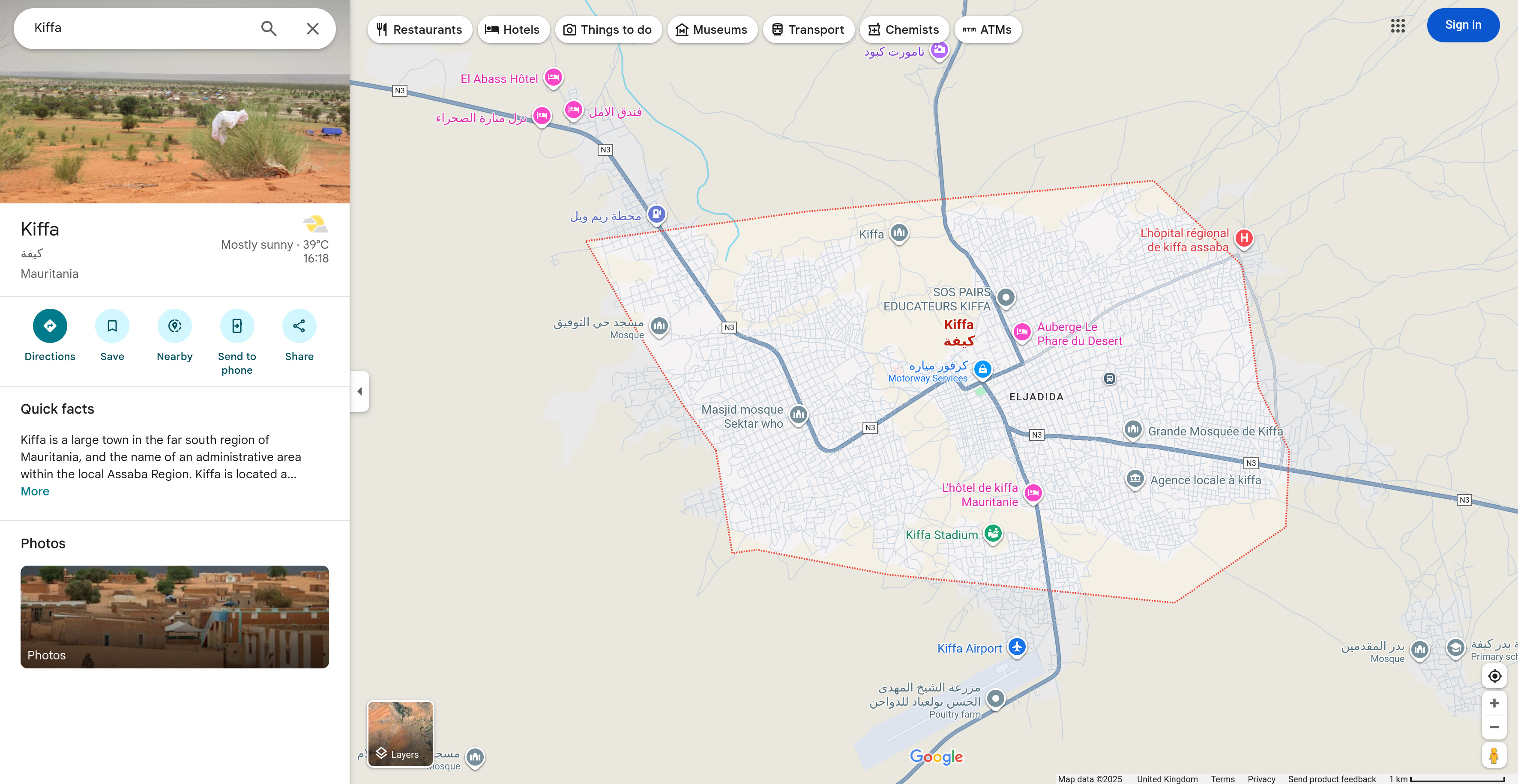
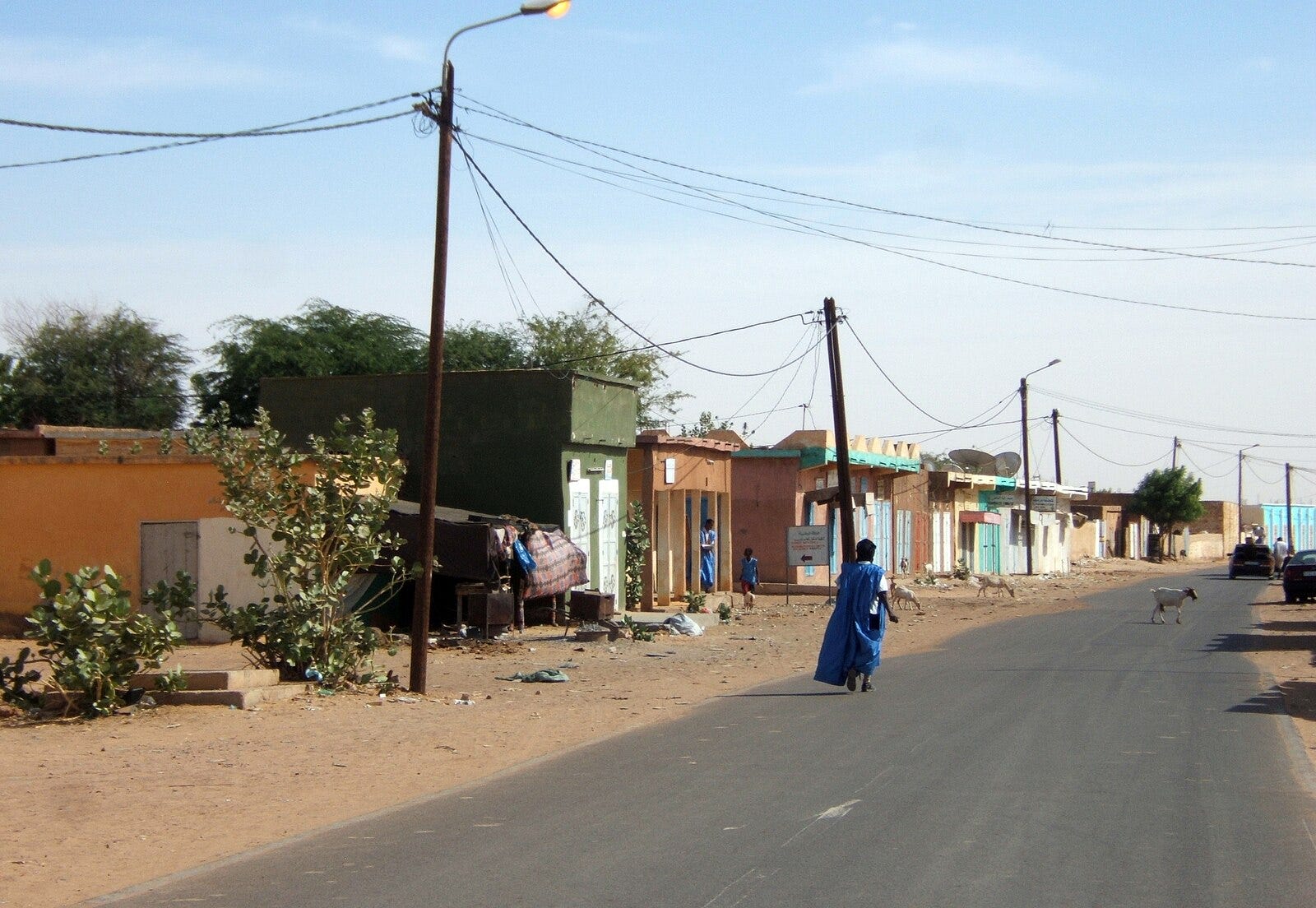
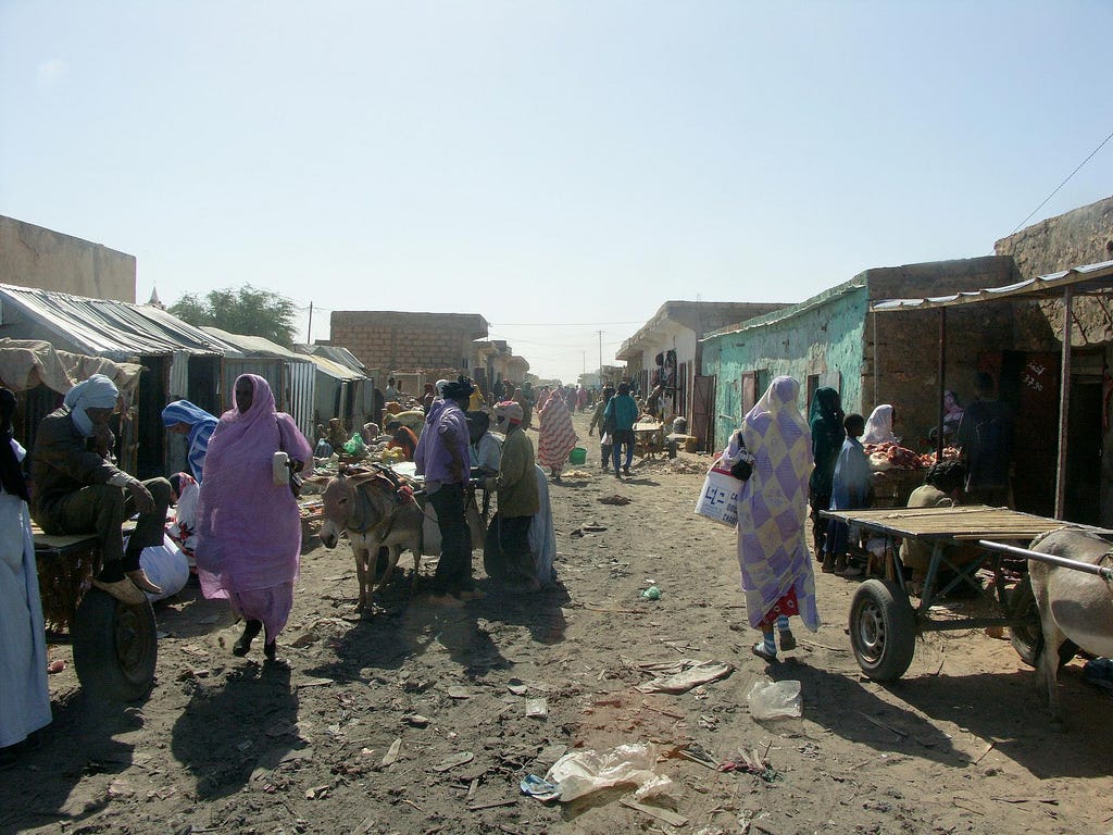
There isn't any other Kiffa. If I check for pictures of the city on Google Images, they look like the same city.
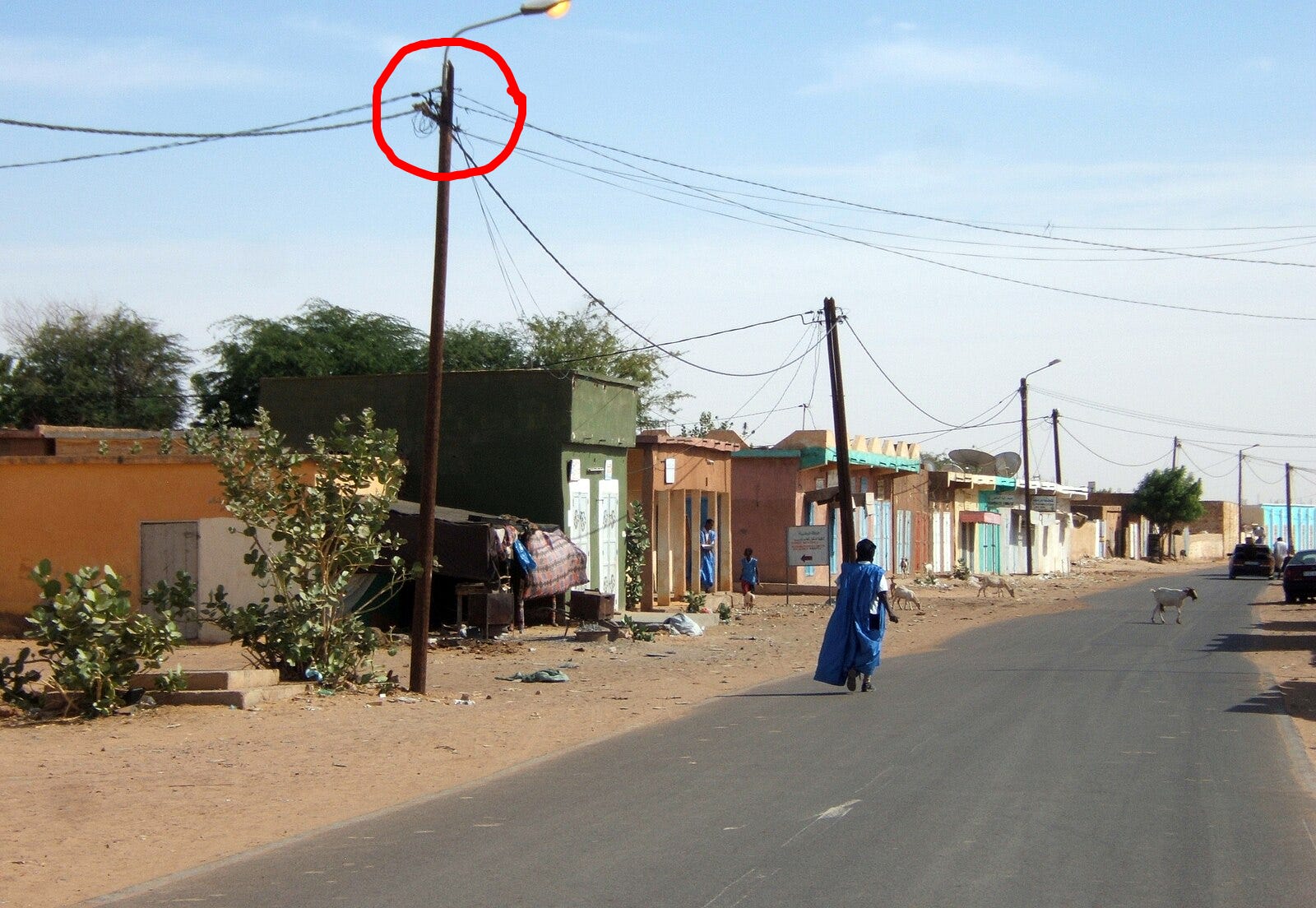
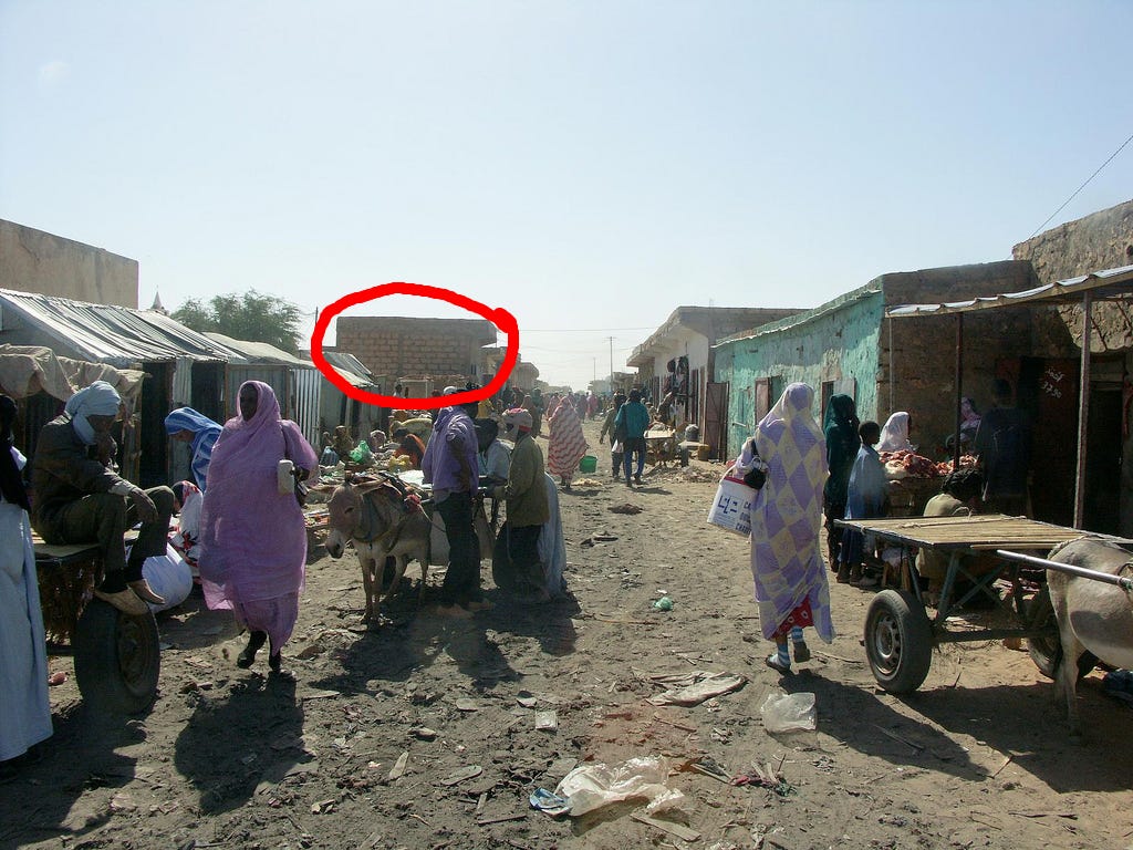
How can I be sure they're the same city? Aside from a vibes-based assessment:
The electric poles from the first pictures are similar (check the circled ones)
The circled building on the second picture is awfully similar to the circled ones on the original image; they're obviously not the same building, but the pattern and the bricks look similar, enough to be part of the shared architecture of a country, region, city, etc...
Tada! Exercise solved!— except I only have the city where the photo has been taken, not the exact coordinates.
The Hard Part
… but is it this hard?
Let's go back to the original image.
Some details seem important to determine the exact location where it's been shot:
A big road, almost straight (sic). It's slightly curved, which might help to identify it.
Electric poles. My favorite.
Trees on the horizon. Seems like there are noticeably more on the right side of the road.
On said right side: buildings close to another.
On the left side: a big stripe of dirt stands between the road the building. I'm sure it has a better name than "big stripe of dirt", I'd like to know a nicer word than "big stripe of dirt", but I'll stick to "big stripe of dirt" for now.
We have quite a few details! I think Sofia Santos exagerated when she ranked this exercise *hard*. Let's just fire up Google Street View and...

Oh. Oh no. Oh geez. Oh boy.
How the turntables have turned…
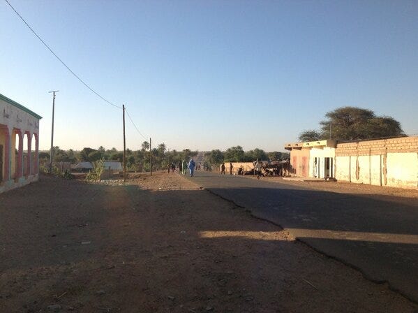
It would have been too easy. No Street View — except for these two fixed positions (I'm sure there's a better name but...):
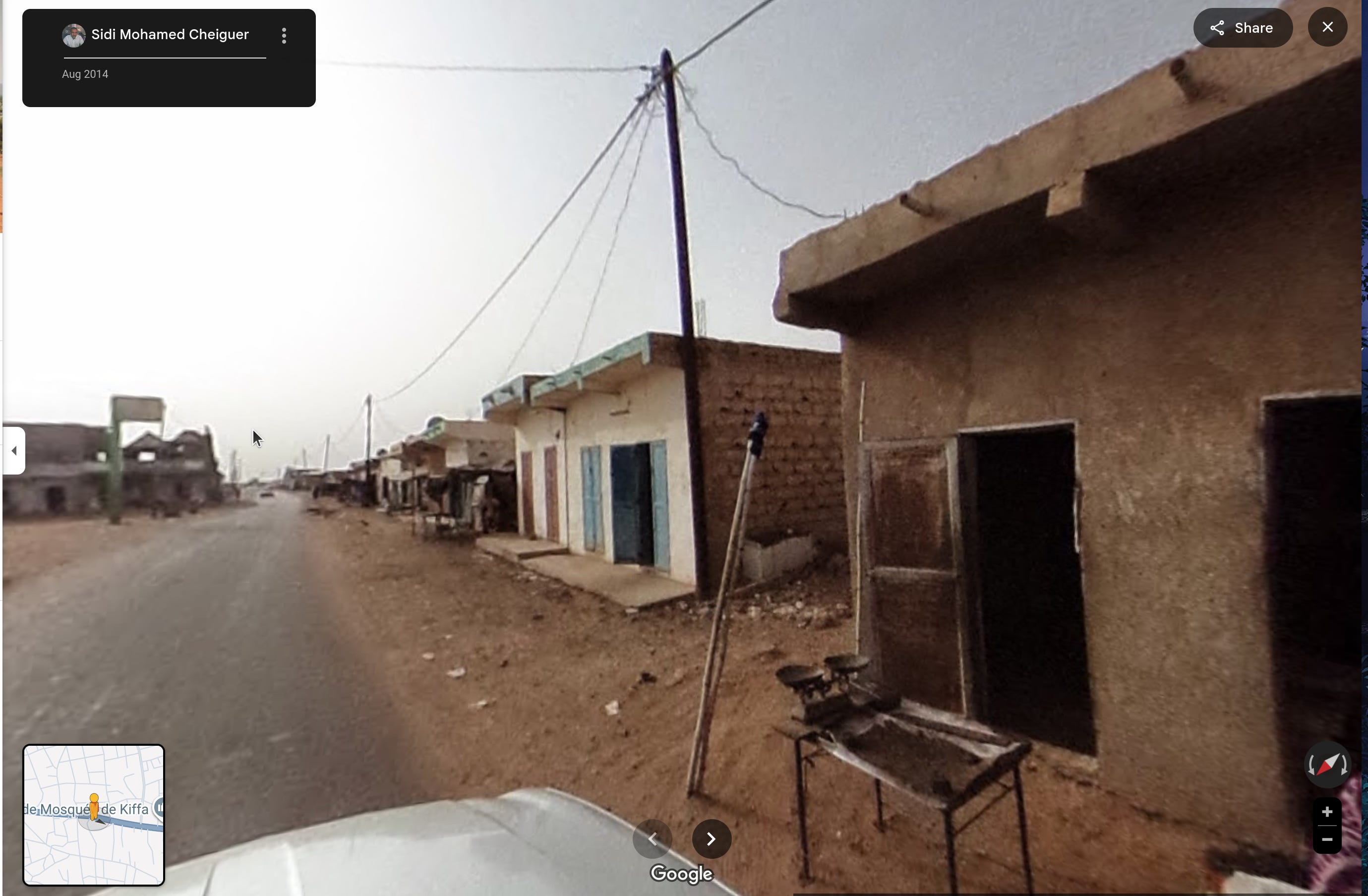
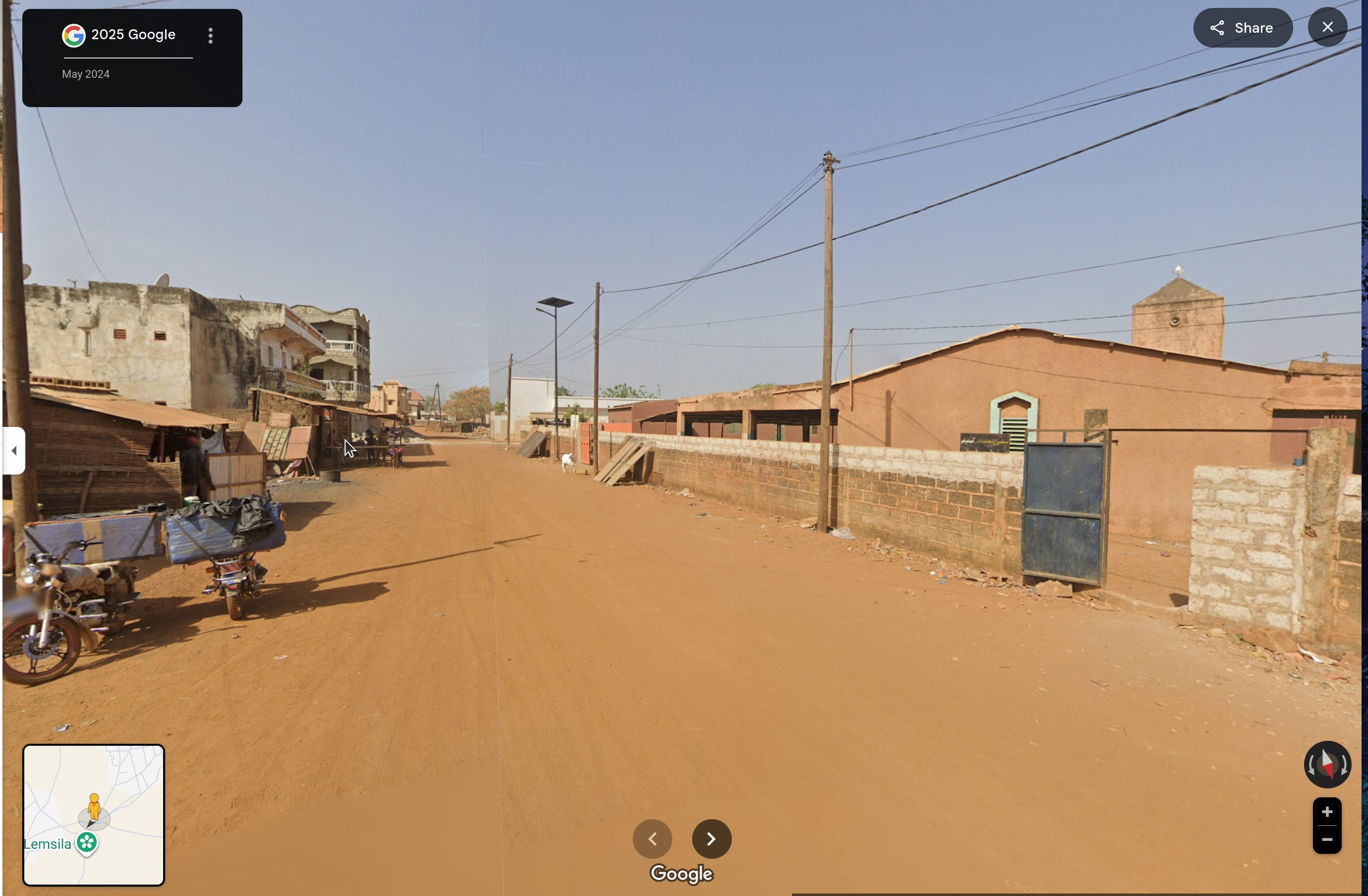
It doesn't help us much, although we are given more signs we're in the right town: electric poles, bricks, colors and roads, *vibes*.
So I guess at this point Google Maps isn't an option. It would be the right moment to launch Google Earth, but I don't really want to observe every angle of every square inch of Kiffa. Good thing we know Kiffa has shown its virtues on the morning this photo has been shot!

I don't know how valid of a technique this is, but hey, the text of the tweet is part of the briefing, so: The suns rises from the east. This photo has been taken in the morning, so I assume the shadow the sun casts comes more or less from the east, which is on the left of this picture, which means we're looking south, at an *almost* straight road, which means we're looking at...
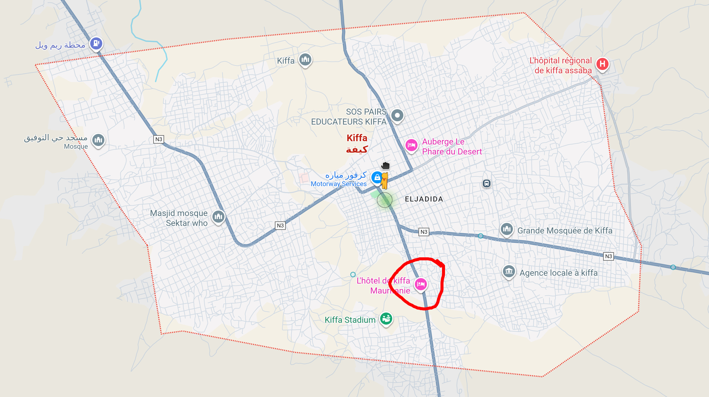
This road. Do you see it? The curve!
Of course, I can't know if it's the right place without using Google Earth, even less obtain the exact coordinates. But the area to inspect has been significantly narrowed!
I'll look around this area: southward from there, you can see the curve of the road and the trees.
Flash Forward
After looking around for five minutes, I realized I was really rusty when it comes to Google Earth! So I took a few hours to play around with it, looked at my old homes and places I've visited... Then I checked some resources, like this article and this video.
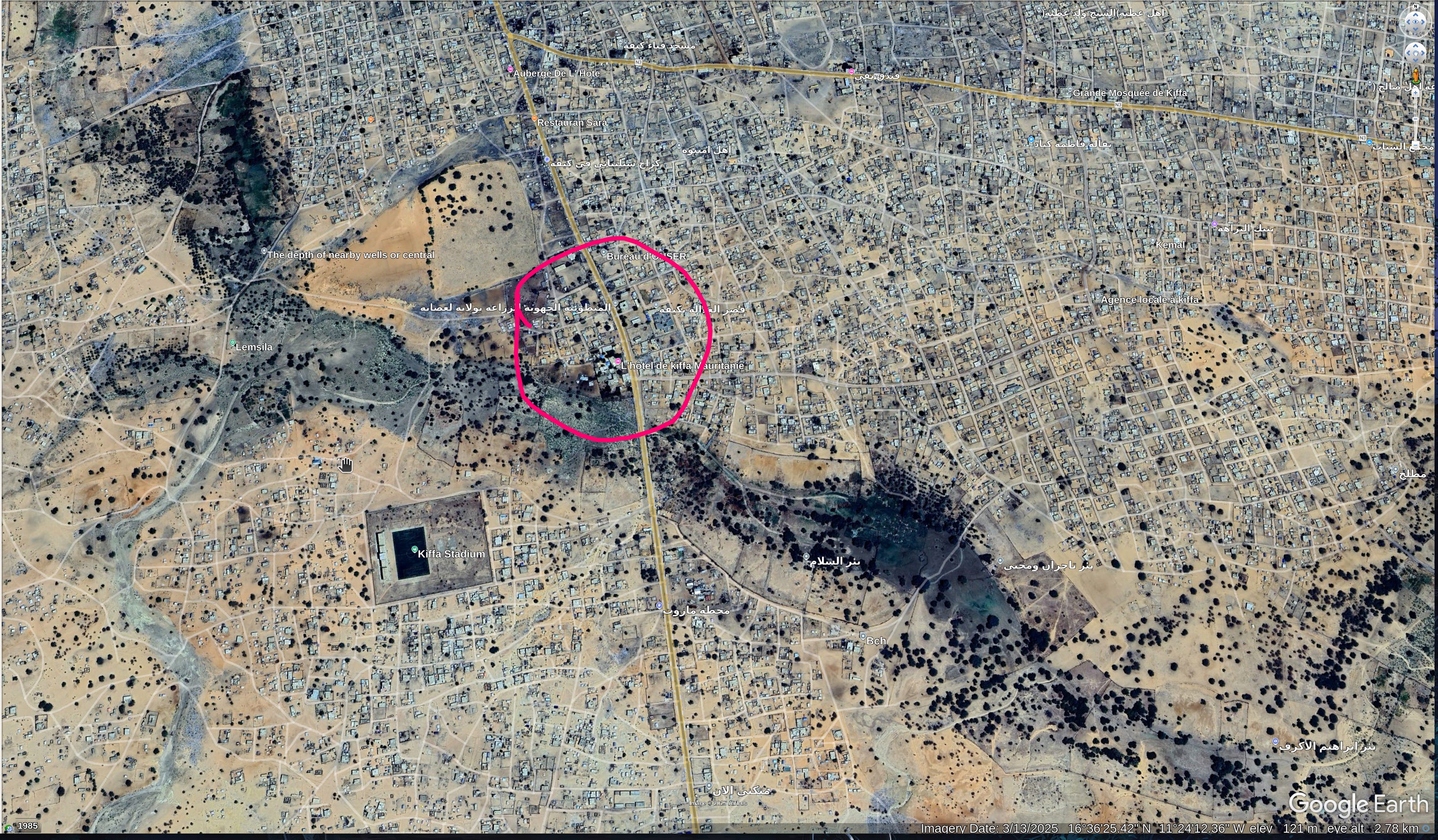
Back to Kiffa, the first thing I did was to change the date of the imagery: I opted to look at December 2022 data, because this exercise has been posted in early 2023 (according to the wayback machine). It doesn't mean the picture isn't older, but it's worth the try.
Anyway: I rotated the map to face the south, then I moved the camera a bit closer, a bit on the left, a bit closer... Until I reached this result.
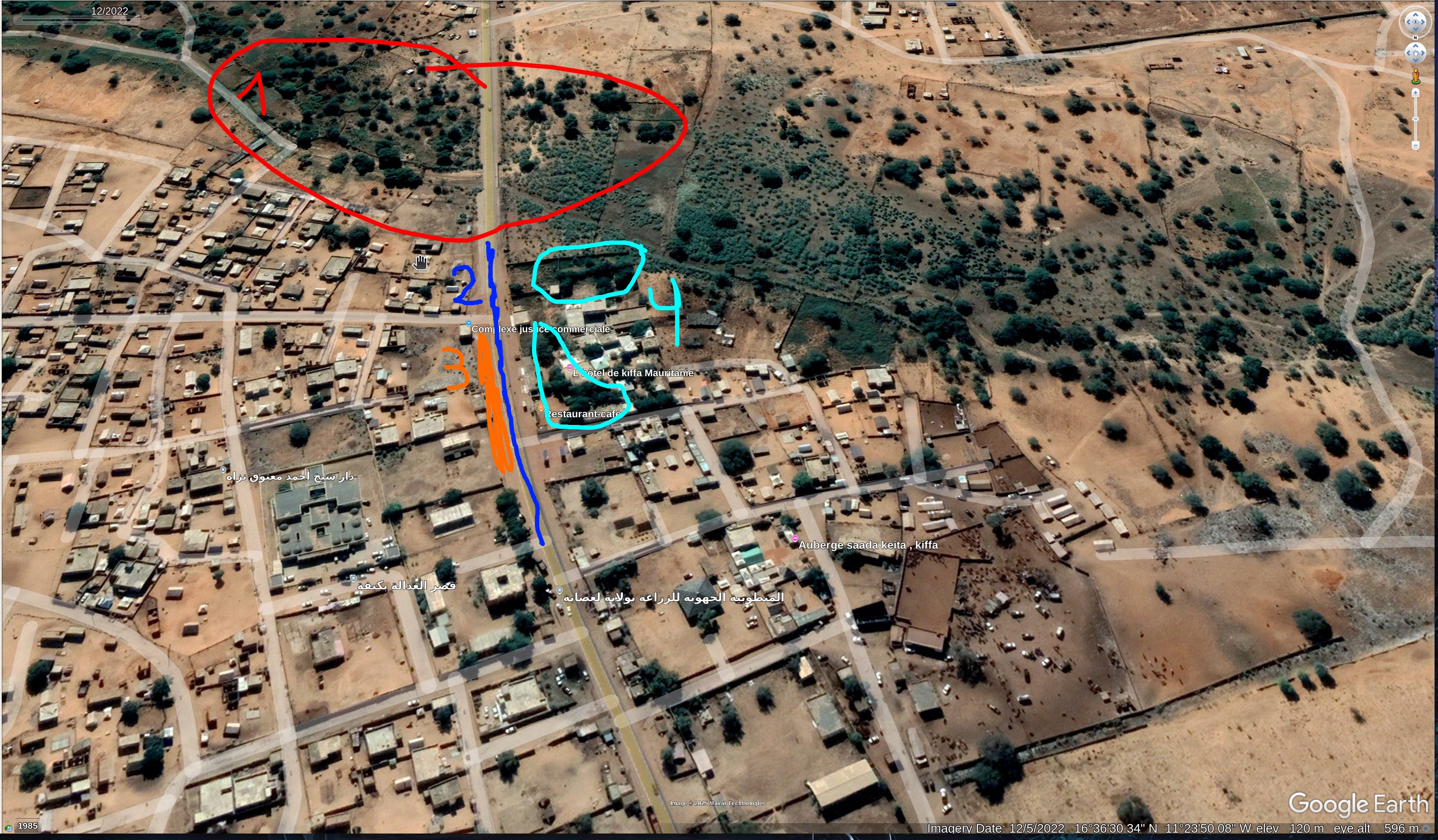
Here, we can see:
The curve of the road
Trees on the horizon
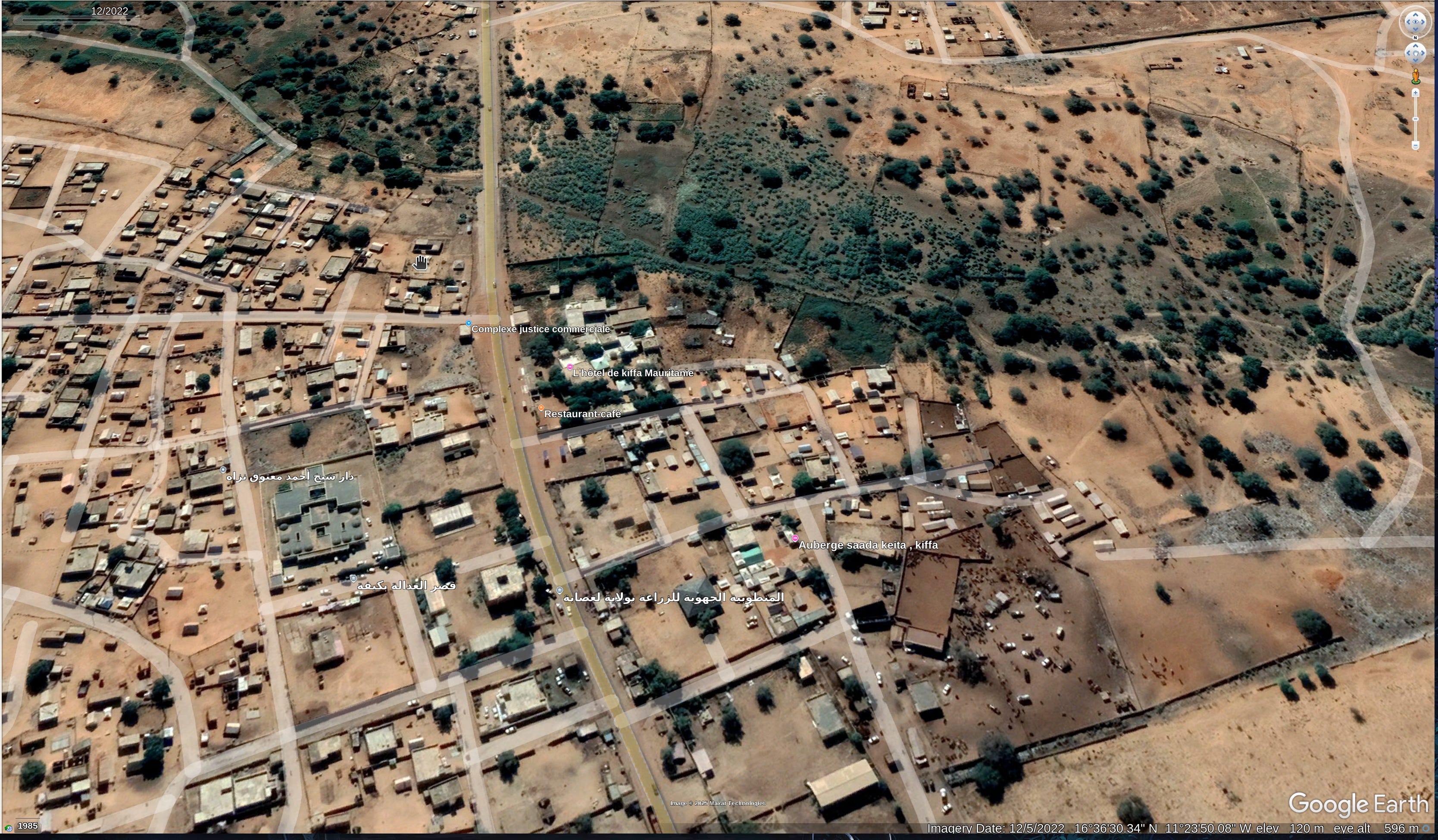
And, a bit closer:
A "big stripe of dirt"
On the right side of the road, trees closer to the position where the photo has been taken, thus appearing bigger
And if we zoom as much as possible and try to recreate the right angle, we have:
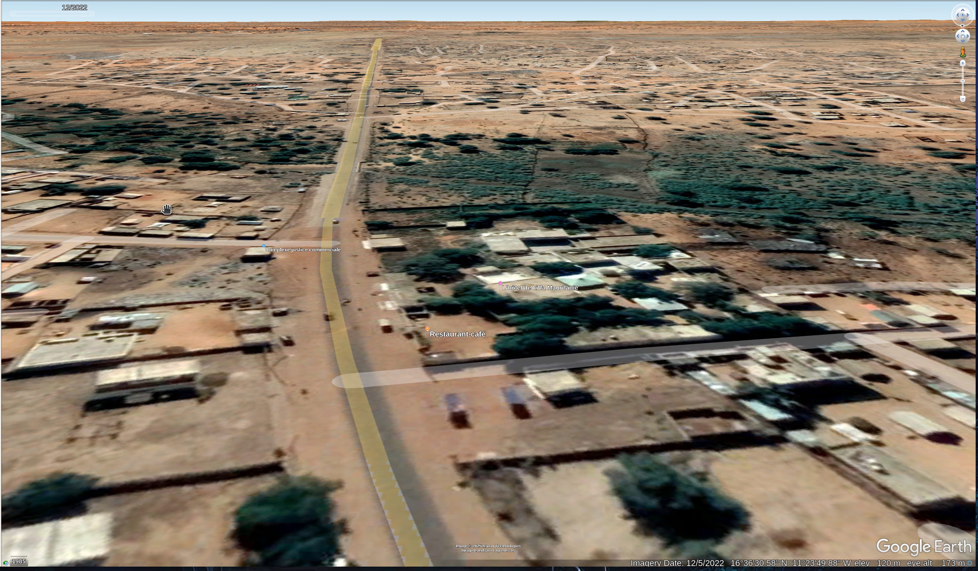
It's all here: the trees on the horizon and on the right side of the road, the *big stripe of dirt*, and the curve of the road. I wish I had a way to know I'm right for sure, but I feel like I've went as far as I can with the tools I have! I think this picture has been taken at the coordinates 16°36'34.26"N 11°23'52.36"W, more or less.
Conclusion
After checking Sofia Santos' walkthrough, I'm happy to say my guess was correct!
One thing I wasn't aware of is the way poles cast shadows that can be picked by satellites. The more you know!
It was a really fun exercise, many thanks to Sofia Santos for designing it. I'll try to complete the others, and document the process! In the meantime — can someone tell me how to call those big stripes of dirt??????